
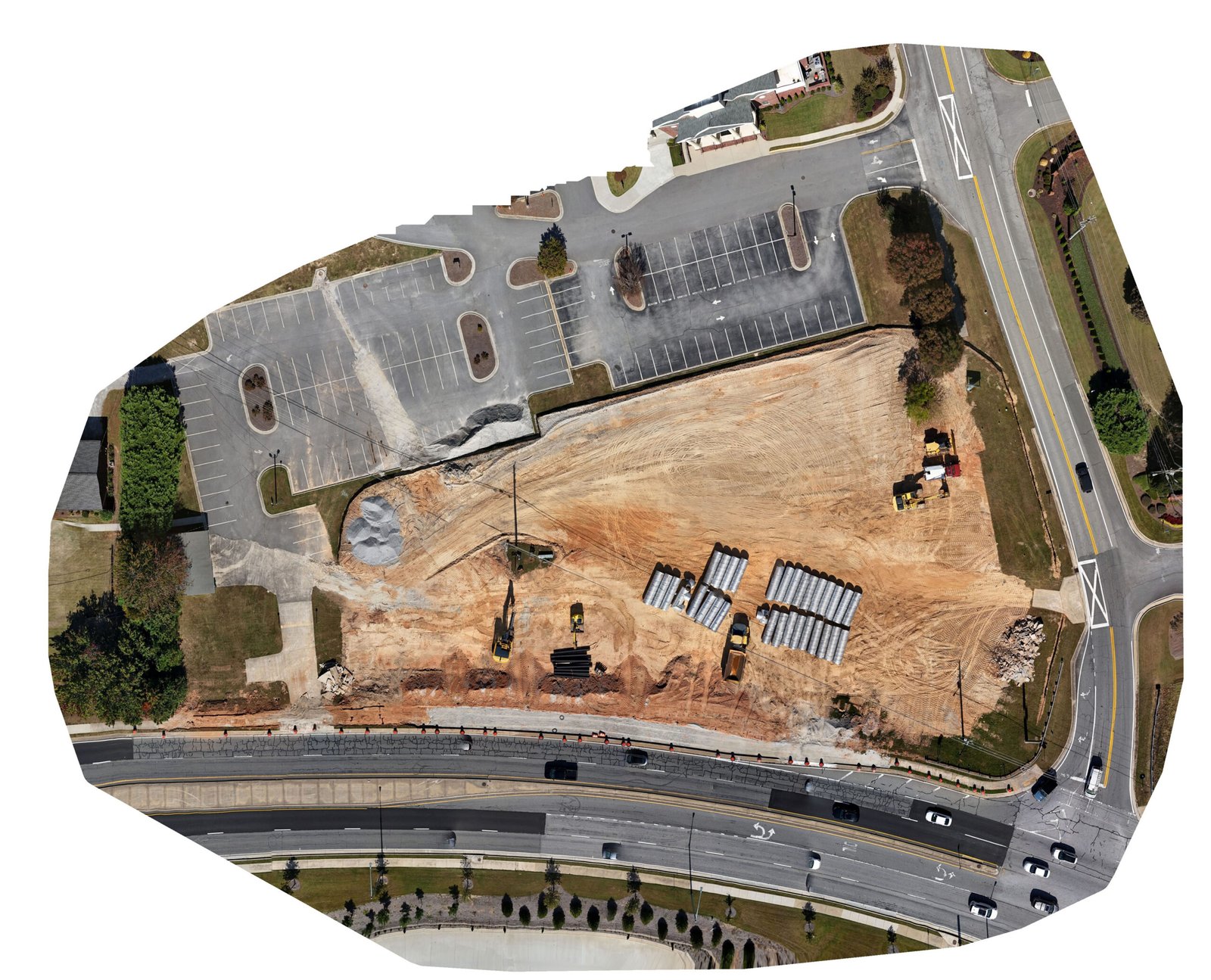
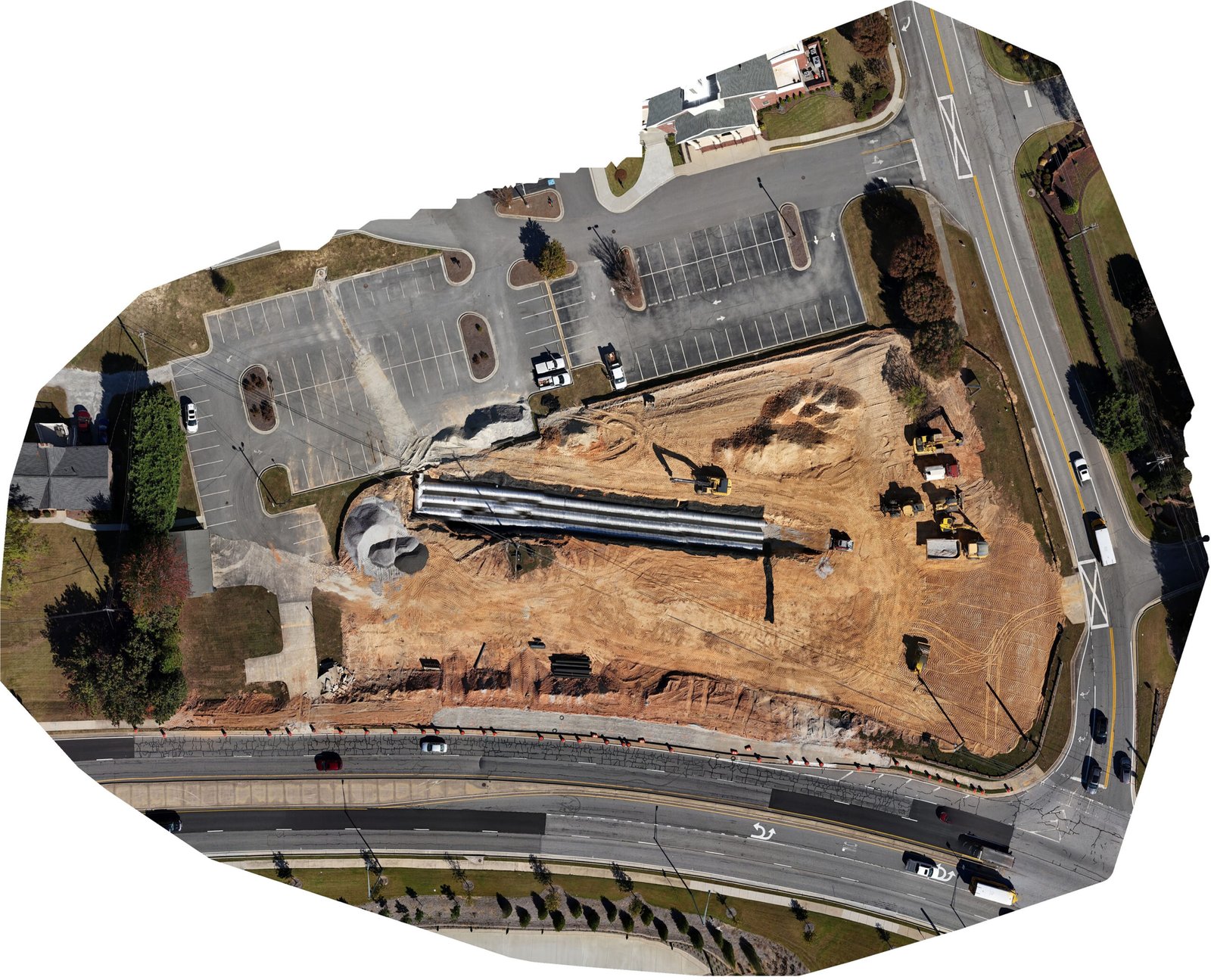
Build smarter with aerial data you can trust. 8 Blade Media delivers repeatable, site‑accurate imaging—progress photos, timelapse video, orthomosaic maps, and 2D/3D models—so your team can monitor work, verify quantities, and keep stakeholders aligned.
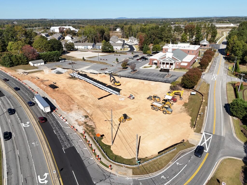
Consistent, repeatable vantage points captured on a weekly, bi‑weekly, or monthly cadence for side‑by‑side comparisons and executive updates.
Cinematic ground + aerial clips stitched over time to showcase milestones, site logistics, and safety briefings.
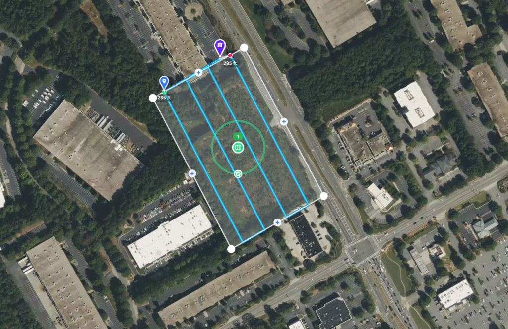
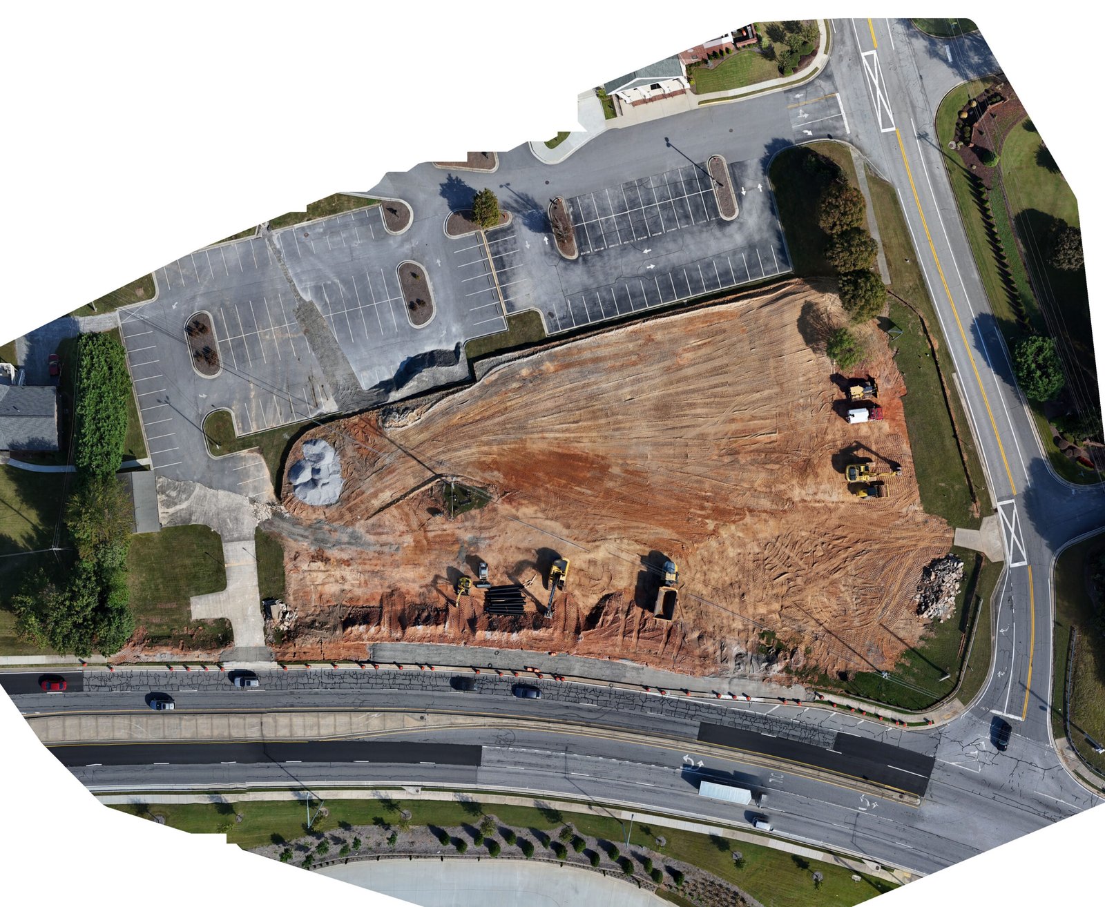
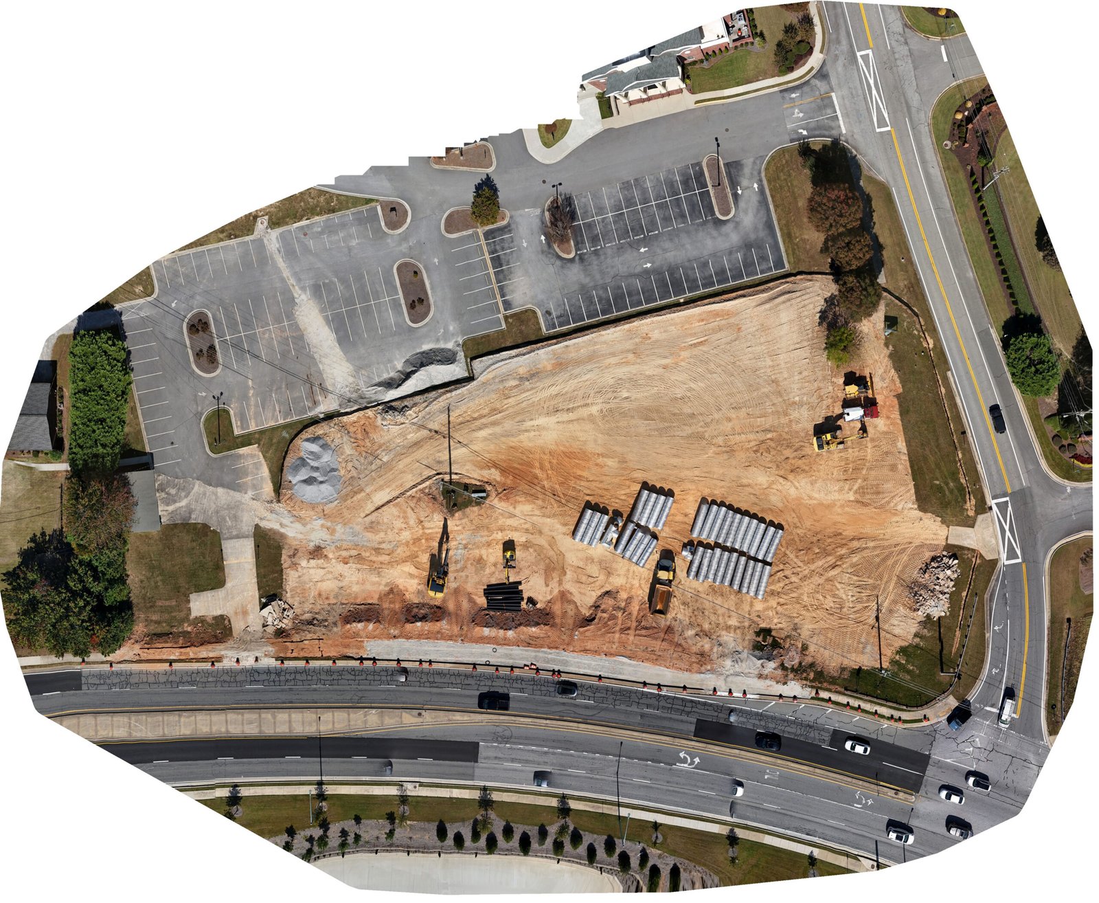
High‑resolution, georeferenced site maps for planning, documentation, and markup. Ideal for “as‑is” snapshots between survey cycles.
Photo‑derived 3D meshes and point clouds to visualize grading, utilities, and structures. Great for clash checks, planning, and site walks.
Track stockpile changes and earthwork indicators between flights. We collaborate with your licensed surveyor for stamped measurements where required.
Create clear visuals for access roads, laydown areas, drainage paths, and as‑built status to accelerate decision‑making and closeout.
How accurate is the mapping?
2D/3D outputs are photo‑derived and great for documentation and comparisons. For survey‑grade deliverables or stamped quantities, we coordinate with your licensed surveyor.
How often should we fly?
Most teams choose weekly, twice monthly, or monthly runs aligned to schedule milestones and pay apps.
Can you work in controlled airspace?
Yes—subject to airspace approvals and site constraints. We handle LAANC/waivers when applicable.
Do you train our team to view the data?
We include a short onboarding so superintendents and PMs can access, measure, and share quickly.
How do you price?
Flat‑rate packages by site size and cadence, with volume discounts for multi‑site programs.
While 8 Blade Media is capable of aerial data collection, visitors should know that we do not interpret survey grade information. For projects where exact measurements count, you still need to rely on a licensed land surveyor or survey engineer. 8 Blade Media can provide data in cooperation with your surveyor, but our data gathering does not replace the need for a licensed land surveyor in any state. This is not exclusive to our business, all drone data collection services cannot interpret data unless they have a surveyor on staff. Additionally, while we can overlay property boundaries on home lots (developed or undeveloped) it is strictly for reference only.